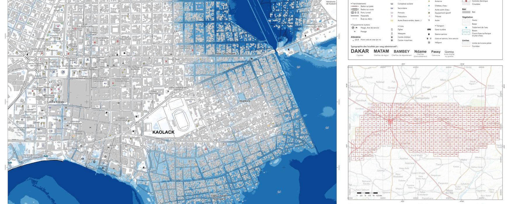
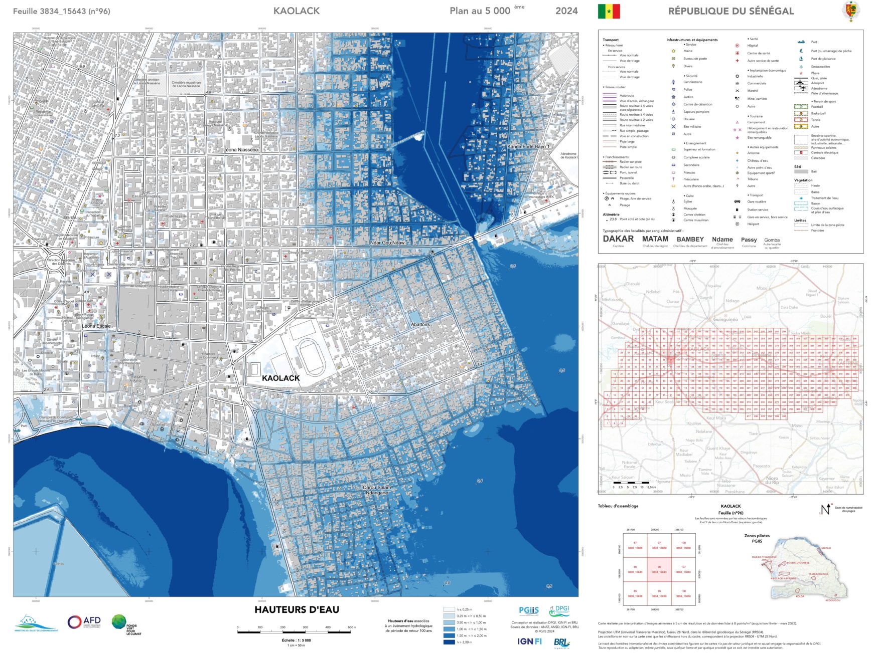
The Minister for Water and Sanitation, Cheikh Tidiane Dièye, presented the results of the scientific study on the mapping of flood-prone areas in Senegal in Kaolack on Tuesday 11 June. This mapping is an awareness-raising tool designed to improve knowledge of the risk of flooding and reduce the vulnerability of areas to flooding.
The minister’s speech took place as part of a special regional development committee devoted to flood management and prevention. The meeting was attended by a large number of representatives. The regional governor, Ousmane Kane, administrative and territorial authorities, regional department heads, grassroots community organisations, civil society organisations and other opinion leaders took part in the meeting.
The APS TV ran a report entitled “results of the flood risk mapping presented in Kaolack” – in French.
A number of media outlets reported the news, including Sud quotidien: https://www.sudquotidien.sn/senegal-cartographie-des-zones-inondables-les-resultats-presentes-a-kaolack/, Dakar Matin : https://www.dakarmatin.com/assainissement-collectivites-les-resultats-de-la-cartographie-des-zones-inondables-presentes-a-kaolack/#google_vignette (in French)
The Integrated Flood Management Project, financed by the Green Climate Fund and the Agence Française de Développement (AFD), is being carried out by the IGN FI/BRLi consortium.