The project for the modernization and rehabilitation of Senegal’s geodetic infrastructure is part of the Land Cadastre and Tenure Security Project (PROCASEF), which aims to establish land management tools across Senegal’s national territory.
The ongoing land reform in Senegal is a key government commitment; it requires a modern, reliable, and precise geodetic reference framework for the entire country, as such an infrastructure is essential to guarantee the geospatial integrity of surveying and positioning work.
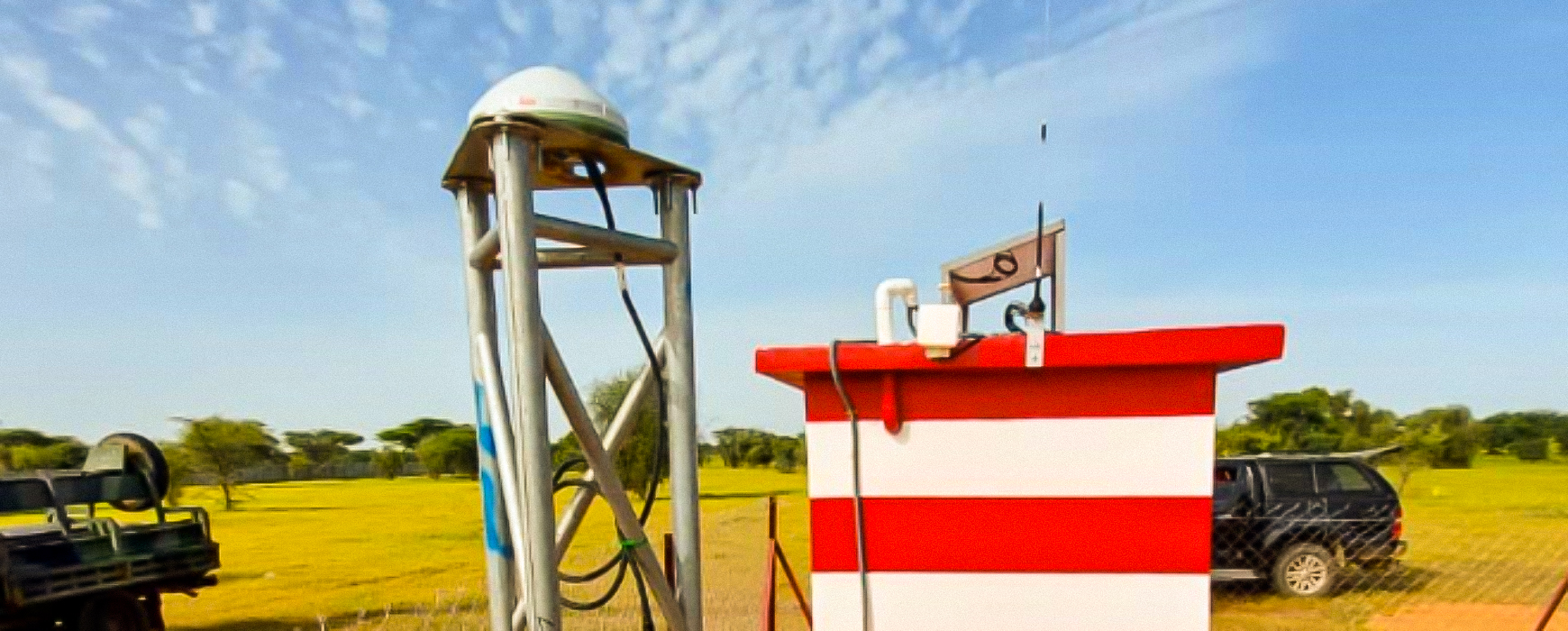
The implementation of this geodetic reference network is carried out by the consortium IGN FI – Leica Geosystems, and includes the establishment of 16 new permanent GNSS stations connected to a control center. This network of modern stations distributed across Senegal’s territory will form the national reference and will be linked to the international system.
Concurrently, the project includes the rehabilitation of existing 1st and 2nd order materialized geodetic networks, the establishment of a geodetic database and a user portal, and a transfer of skills to the technical staff who will be responsible for monitoring.
The GNSS observation mission for the materialized networks is currently underway, with dynamic field teams (IGN FI, ANAT, CADASTRE) following a rigorous methodology essential to guarantee the precision and reliability of the new reference. The GNSS observation sessions are conducted with high-precision equipment and are duplicated for each of the 160 points of the rehabilitated national network. Radio spots accompany the missions to raise public awareness.